Delhi Weather Today: IMD Yellow Alert as Showers Bring Relief, AQI Improves
How Friday’s weather will play out
Clouds finally did the heavy lifting this morning in Delhi-NCR. If you’re checking Delhi weather today, here’s the quick read: the India Meteorological Department (IMD) expects light, frequent showers with a high chance of rain through the afternoon and evening. Morning temperature hovered around 25.9°C, and the day is likely to top out near 33.6°C—warmer on paper, but the cloud cover should keep the heat from feeling harsh.
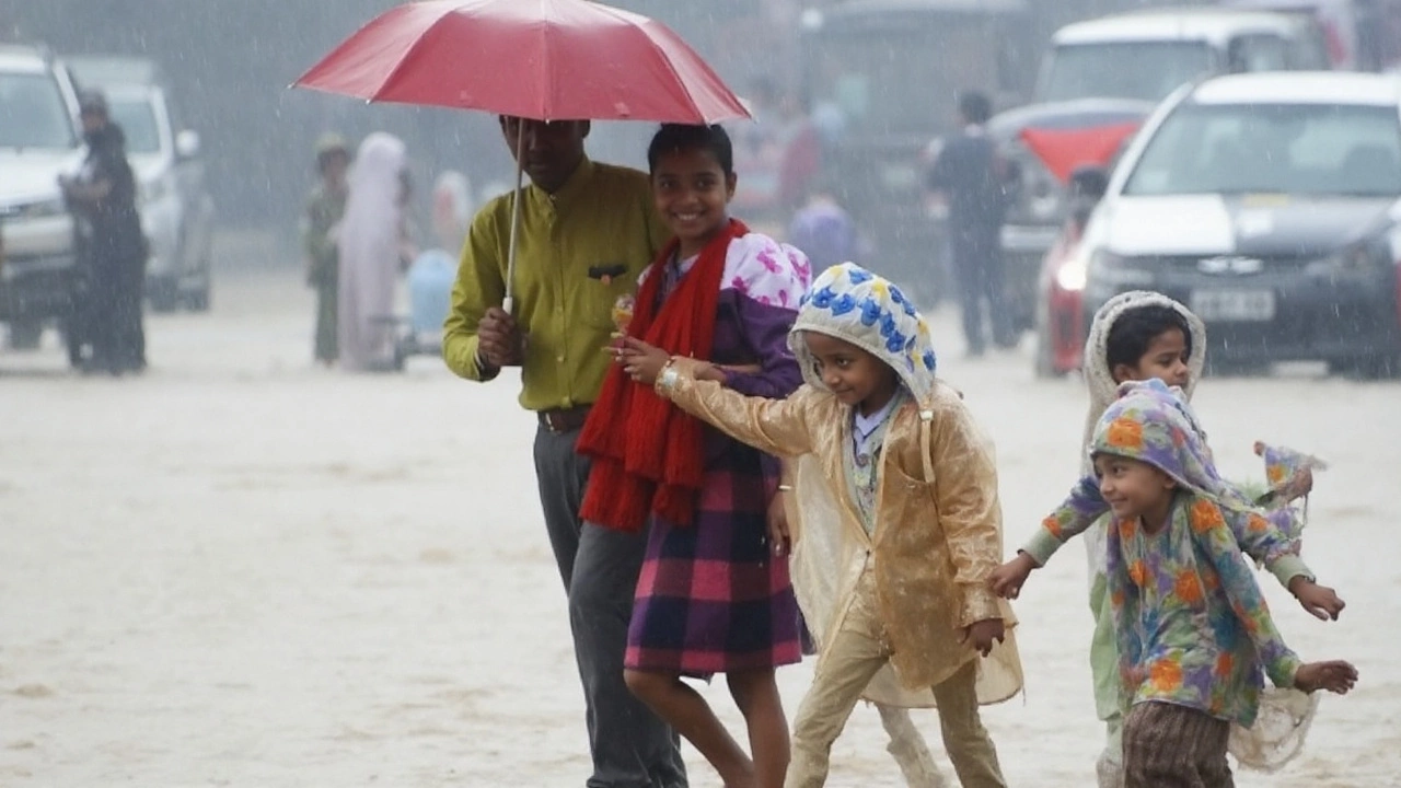
Expect generally cloudy skies and one or two brief thundershowers. The headline number is an 87% probability of precipitation, which basically means showers are likely at some point for most parts of the city. The setup favors on-and-off drizzle and light rain, with a few moderate bursts possible in isolated pockets during late afternoon or early night.
Humidity is sitting at about 71%, and winds could reach around 20.2 km/h at times. That breeze will help with comfort and also push along rain bands as they move across the city and suburbs. Morning hours have been fine for outdoor plans, but keep rain gear handy—cells can pop up quickly and move through in 20–40 minutes before easing off again.
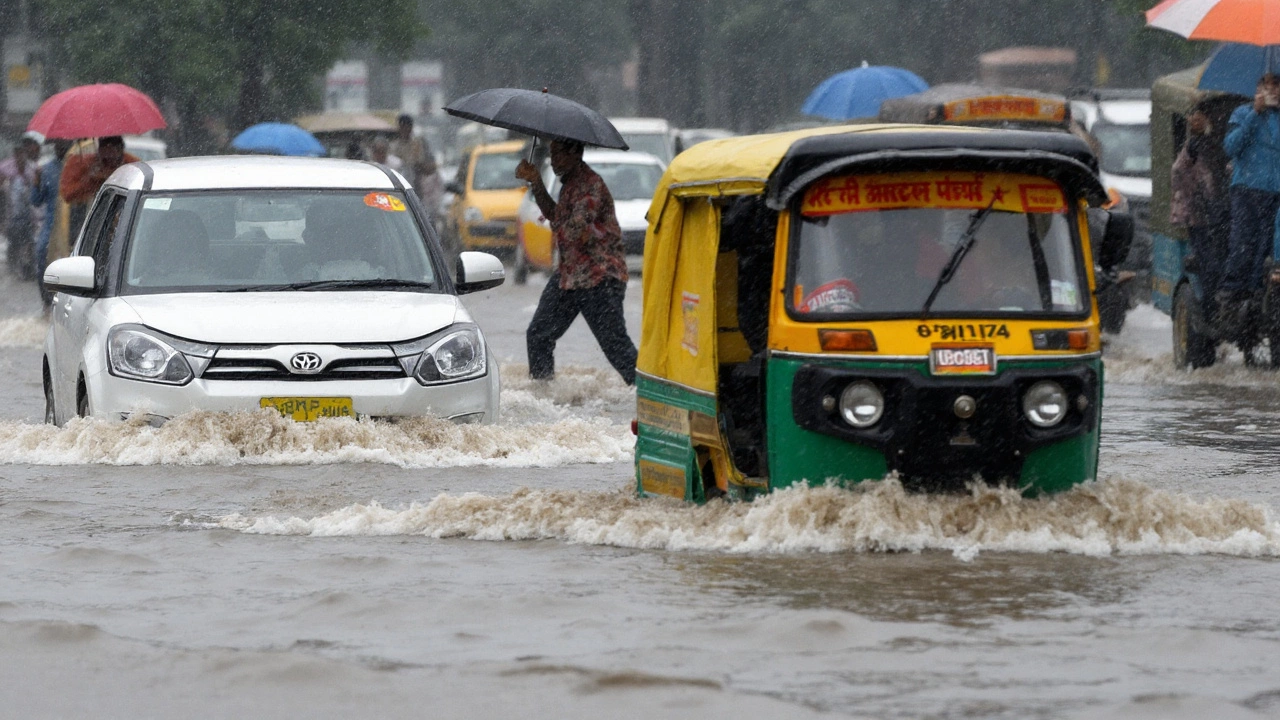
NCR towns—Gurugram, Noida, Ghaziabad, and Faridabad—should see a similar pattern: long cloudy spells, scattered light rain, and a few short, sharper showers as the day wears on. Localized waterlogging is possible where drains are slow, especially near underpasses and low-lying stretches. If you’re driving around the afternoon peak, budget a little extra time.
Why does the forecast mix “light” and “moderate” rain? In this kind of monsoon phase, most neighborhoods get drizzle or light rain, but a few zones under healthier cloud clusters catch heavier downpours for 15–30 minutes. That’s why the citywide alert stays on the moderate side even if a couple of spots briefly get drenched.
What IMD’s Yellow Alert means for you
A yellow alert is a heads-up, not a shutdown. It’s IMD’s way of saying: be aware, conditions are favorable for rain and thundershowers, and some areas can see brief moderate spells. Think routine caution—carry an umbrella, watch for slippery patches, and avoid known waterlogged routes if a shower just passed.
Air quality has already responded to the recent rain. Delhi’s AQI stands around 75, which is in the moderate range for the city’s scale. The numbers behind it: PM2.5 at 29 µg/m³ and PM10 at 75 µg/m³ yesterday, with carbon monoxide around 578 µg/m³. Showers tend to “wash out” fine particles, so short-term improvement is likely through the day. Still, if you’re sensitive—asthma, COPD, or heart conditions—keep a mask handy during commute hours when dust and vehicle exhaust can briefly spike.
The weather mix today should feel easier than earlier in the week for most people. Yes, humidity is up, but the cloud deck keeps direct sunlight in check. Even with a forecast high near the mid-30s, the perceived heat will be milder whenever showers are nearby. If the sun breaks out for a bit between spells, it can feel warm—then the next passing shower cools things down again.
The Yamuna remains on everyone’s radar. At 7 am, the level at the Old Railway Bridge in Delhi was 207.33 metres, down from Thursday’s season-high of 207.48 metres. That’s a welcome turn. The level is still above the danger mark of 205.33 metres, but officials expect a gradual decline through the day if upstream inflows keep easing. If you live or work near the floodplain, keep an eye on updates and avoid accessing the riverbed and adjoining kuccha tracks. Even a brief upstream rain burst can slow the fall.
This pattern is part of a broader rainfall phase over northern India. Several states have picked up notable showers this week, and the belt remains unsettled. For Delhi-NCR, that usually translates into quick changes: an hour of calm skies, a fast-moving shower, then a quiet patch.
Commuters and parents juggling school runs might want a simple game plan for the afternoon window when showers are most likely. Transit times can stretch if a cell passes over a key junction. Surface visibility can dip during a thundershower, and two-wheelers are the first to feel slick spots. If you have airport runs, add extra buffer—short delays are possible when showers line up with peak movement.
- Keep an umbrella or light rain jacket accessible, not buried in a bag.
- Avoid parking under old trees if gusts pick up with thunder.
- Stick to well-lit, well-drained roads after a shower; potholes hide under water.
- If you feel a sudden cool wind and darker clouds, a shower is minutes away—pause before starting a long ride.
For runners and walkers, morning windows were the best bet. If you plan an evening loop, pick routes with cover options and be okay with a quick stop if thunder rolls in. Hydration still matters even in cooler conditions; humidity and light sweat can sneak up on you.
Events and deliveries should be fine with minor adjustments. Outdoor vendors may want plastic covers ready for surprise drizzles. Construction sites should secure loose materials by afternoon to avoid runoff and slick access points.
How long could this phase last? IMD’s yellow alert signals a day built for spells rather than a nonstop soak. The pattern often lingers into the night with light drizzle after the main showers fade. The department will issue fresh bulletins if a stronger band builds upstream, so it’s worth checking updates in the late afternoon.
A quick note on the numbers: a forecast rain probability near 87% doesn’t mean it rains hard for 87% of the time. It means most of the region is likely to see some rain at some point today. That’s why umbrellas matter even if your morning started dry and bright.
Bottom line for Friday: cooler feel, cloudy skies, rain on and off with a better chance post-lunch, and improving air. Keep plans, just stay flexible. The city gets a breather from the heat, and the showers do the cleanup.